

The Geology of Arizona: A Journey Through Time and Stone
Arizona is renowned for its stunning landscapes and iconic natural wonders. The state is also a geological treasure trove! From the stunning Grand Canyon to the surreal Petrified Forest, Arizona's geology tells a fascinating story that spans billions of years. Read on to delve into the geological features and history of Arizona, and learn about the processes that shaped this remarkable state.
The Grand Canyon: A Geological Marvel
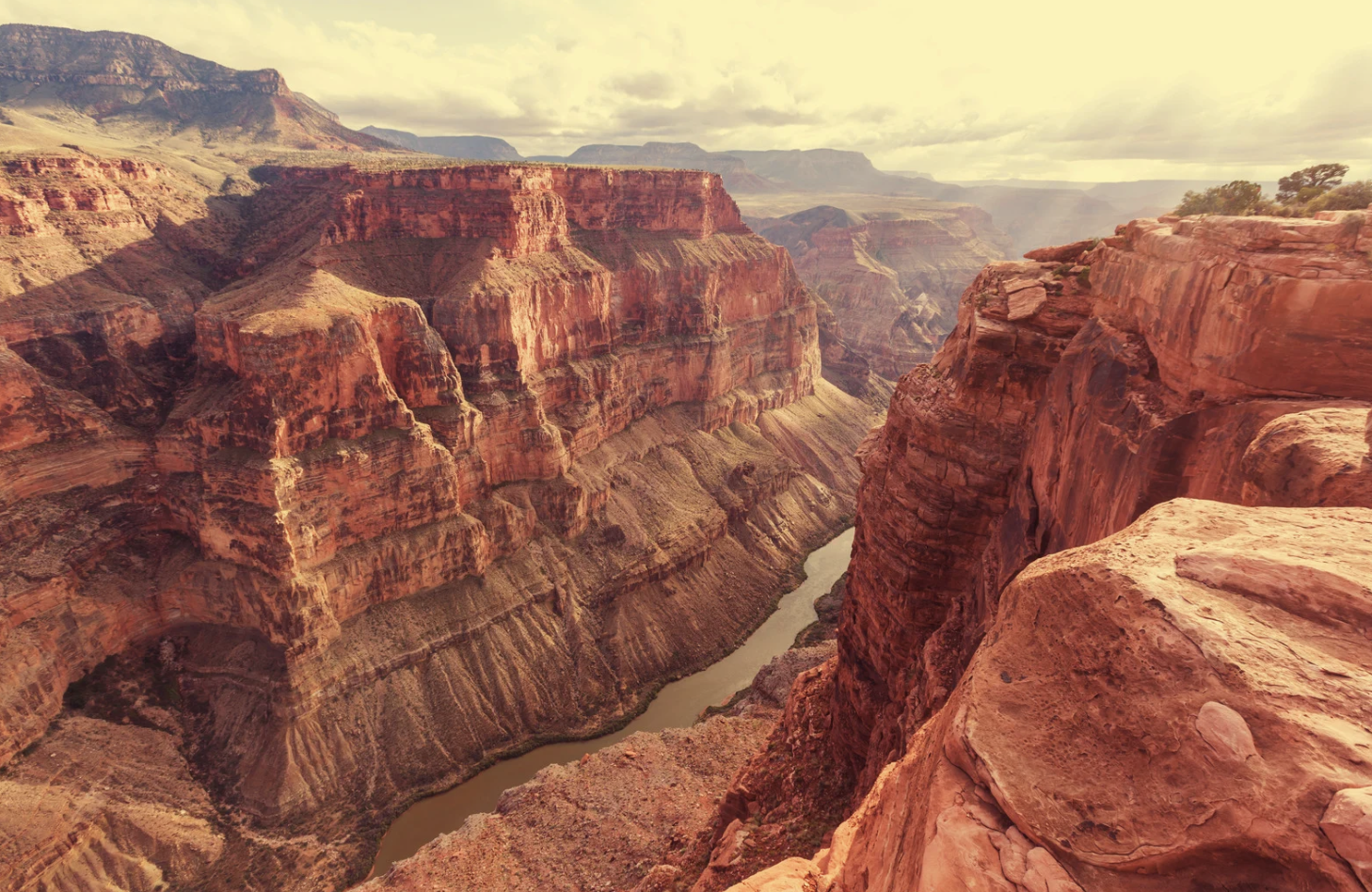
Perhaps the most famous geological feature in Arizona is the Grand Canyon. Carved by the Colorado River over millions of years, the Grand Canyon reveals a cross-section of Earth's crust that spans nearly two billion years. The canyon's stratigraphy includes layers of sedimentary rock, such as limestone, sandstone, and shale, interspersed with ancient volcanic rock.
Key highlights:
Vishnu Basement Rocks: At the bottom of the Grand Canyon, these metamorphic rocks date back nearly two billion years, offering a glimpse into the early crust of the Earth.
Bright Angel Shale: This greenish-gray layer, around 515 million years old, is rich in marine fossils, reflecting a time when Arizona was submerged under a shallow sea.
Kaibab Limestone: Forming the rim of the Grand Canyon, this 270 million-year-old layer consists of marine limestone and fossils, indicating a period when the region was a seabed.
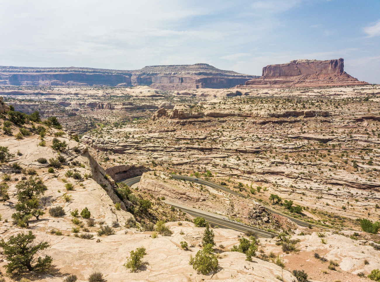
The Colorado Plateau: A Geological Wonderland
The Grand Canyon is part of the larger Colorado Plateau, a region that covers northern Arizona and extends into neighboring states. This high desert plateau is characterized by its flat-lying sedimentary rocks, which have been uplifted and eroded into dramatic cliffs, canyons, and mesas.
Significant features:
Monument Valley: Famous for its towering sandstone buttes, Monument Valley's geology dates back to the Permian period, around 250 million years ago.
Painted Desert: This area of the plateau is known for its colorful banded rocks, composed mainly of Triassic mudstone, siltstone, and shale, deposited over 200 million years ago.
 Volcanic Activity: Shaping Arizona's Landscape
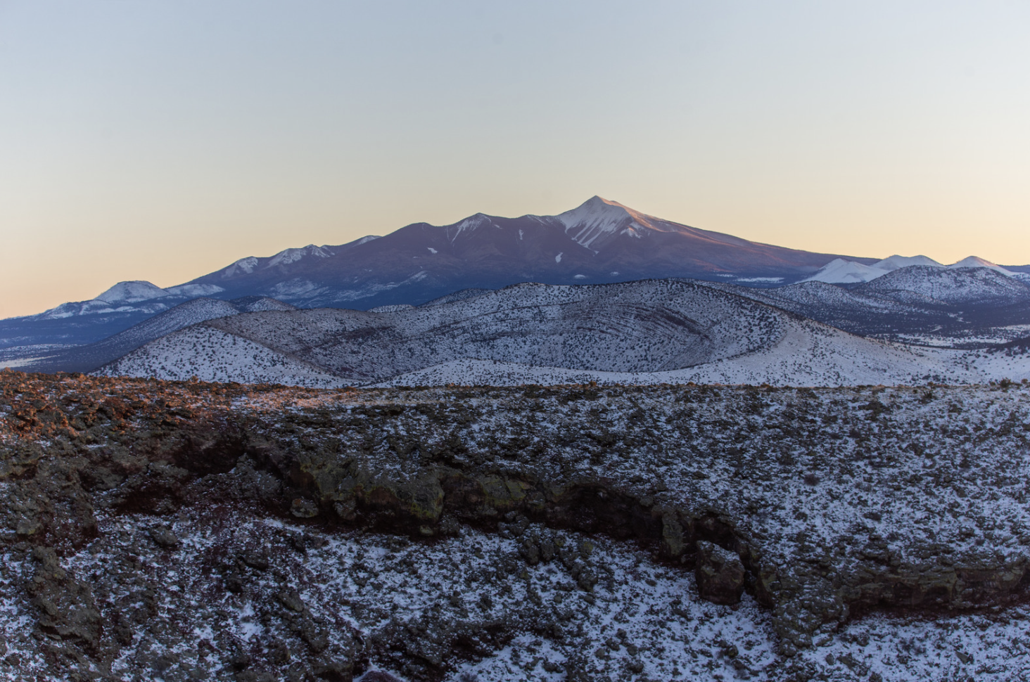
Arizona's geological history is also marked by significant volcanic activity. The state is home to numerous volcanic fields, each with its unique features.
Notable volcanic regions:
San Francisco Volcanic Field: Located near Flagstaff, this region includes the San Francisco Peaks, with the highest point in Arizona, Humphreys Peak, rising to 12,633 feet. The field is dotted with cinder cones, lava flows, and volcanic domes, the result of eruptions over the past six million years.
Sunset Crater: A relatively young volcano, Sunset Crater erupted around 1,000 years ago, creating a cinder cone and extensive lava flows that are still visible today.
 The Basin and Range Province: A Landscape of Contrasts
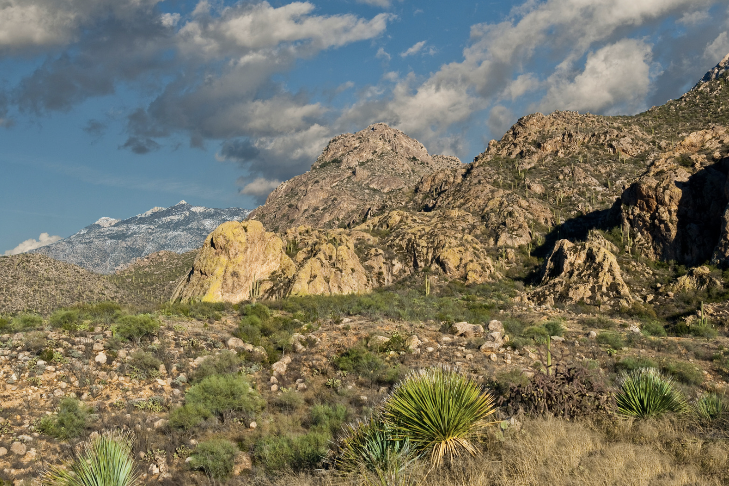
Southern Arizona is part of the Basin and Range Province, a region characterized by alternating basins (low areas) and ranges (mountain ranges). This landscape was formed by extensional tectonics, where the Earth's crust is being pulled apart.
Key features:
Santa Catalina Mountains: These mountains, near Tucson, are an example of a metamorphic core complex, where deep crustal rocks have been uplifted and exposed by extensional forces.
Sonoran Desert: This desert region features extensive alluvial fans, bajadas, and desert pavement, created by erosion and sediment deposition.
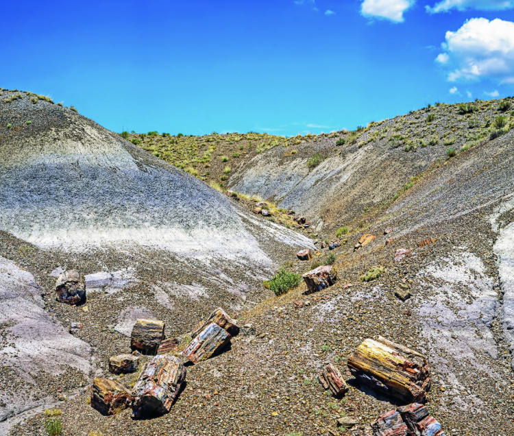 The Petrified Forest: A Glimpse into the Past
The Petrified Forest National Park, located in northeastern Arizona, is renowned for its fossilized trees. These ancient logs date back to the Late Triassic period, around 225 million years ago. The park's colorful badlands are composed of sedimentary rocks from the Chinle Formation, which also contains fossils of early dinosaurs and other prehistoric life.
Arizona's geology is a rich tapestry woven from billions of years of Earth's history. The state's diverse landscapes, from the towering cliffs of the Grand Canyon to the ancient volcanic fields and the fossil-rich badlands, offer a unique window into the dynamic processes that have shaped our planet. Whether you're a geologist, a nature enthusiast, or simply a curious traveler, Arizona's geological wonders are sure to captivate and inspire.
Resources
1. U.S. Geological Survey (USGS) Provides detailed geological maps and information about Arizona's geology.
2. Arizona Geological Survey (AZGS Offers resources, publications, and maps related to the geology of Arizona.
3. National Park Service (NPS) Manages many of Arizona's geological landmarks, including the Grand Canyon and Petrified Forest National Park, and provides educational materials and visitor information.
4. University of Arizona, Department of Geosciences Conducts research and offers educational programs related to the geology of Arizona and the Southwest.
By exploring these resources, you can deepen your understanding of Arizona's geological history and appreciate the natural forces that have crafted this magnificent state.
#ArizonaGeology, #Volcanos, #GrandCanyon, #PetrifiedForest, #VishnuBasementRocks, #BrightAngelShale, #KaibabLimestone, #MonumentValley, #PaintedDesert
